Archive for the Urban Geography Category

State Street Park: revitalized or sanitized?

Posted in Political Geography, Urban Geography on April 29, 2009 by geography101

Thanks to Sarah Bennet for sending in this link from this week’s Isthmus on the ‘revitalization’ of Peace Park on State Street. The Isthmus asked the park’s current users about the proposed changes:

picture-1A 54-year-old man going by the nickname “Smooth”…likes Peace Park as it is.

“This is just the place we hang out,” says Smooth, who is passing a can of beer stuffed into a leather glove among his buddies. “It’s our little spot.”

Smooth, who is currently unemployed, says he hangs out at the park six days a week, from noon until early evening. He’s heard talk of renovations for years and seen some changes. For instance, the tall bushes behind which people would sometimes sleep (or have sex) have been trimmed low to the ground. He wonders if there isn’t another agenda.

“Sometimes change is a removal thing,” he says. “Urban renewal — I call that ‘urban removal.'”

[Alderman Mike] Verveer admits he’d like to remove some of the park’s reputation. “Over the years the park has been a magnet for street people,” he says. “It’s a place where people hang out. They’re not overall scary mean people, but there’s a perception that they’re scary.” He notes that the park was the first place police put surveillance cameras.

Read the full article here

Where Race Lives: PBS interactive website on the geography of race and urbanism

Posted in Urban Geography on April 14, 2009 by geography101

Click on the picture below to learn more about how federal policies helped shape the racial geographies of suburbanization and ghettoization in US citiespicture-3


The end of an era: the Brewster Housing Projects in Detriot

Posted in Urban Geography on April 14, 2009 by geography101

Nate Millington sent in this blog which speaks directly to the topic of our lecture today on postwar urbanization. The story documents the decline of the Brewster Housing Projects in Detroit. A quote from the blog:

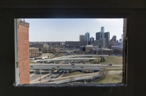
View of Detroit from the Brewster Housing Projects

View of Detroit from the Brewster Housing Projects

They were the first federally funded public housing development for African Americans, remnants of a time when black citizens faced restrictive covenants in land deeds that prevented them from moving into white neighborhoods. The projects were built when the development of I-75 displaced residents of the black neighborhood of Paradise Valley. Last year at this time, people were still living in several of the towers until the housing commission shut operations down for good. By June 2008, the only people living in the towers were squatters and scrappers diligently removing all recyclable metals from the four towers and numerous low-rises”

Read the full story on the projects in the Sweet Juniper blog here

Slumdog Millionaire: developmentalism on film?

Posted in Geography and Globalization, Urban Geography on April 11, 2009 by geography101

The film Slumdog Millionaire has set of a heated debate in India, and rippled across the western World.

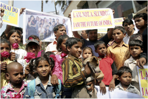
Protests outside the studio of actor Anil Kapoor

Protests outside the studio of actor Anil Kapoor

Alice Miles a reporter for the Times London Calls the film an example of ‘poverty porn’ – where a a grassroots, insiders view of the ‘the slums’ is served up for a voyeuristic western audience.

Sadia Sheppard, documentary filmmaker and author writes:

More troubling than Mr. Boyle’s facile characterization of life in Asia’s largest slum is how the national argument over India’s representation in popular culture seeps into the urban solutions proposed for Dharavi, notably a new redevelopment plan which would demolish the slum and relocate some of its residents to a complex of towers…a sentiment that goes hand in hand with Bollywood’s glossy view of reality.

Here is a link to a blog on the story : ‘The Real Roots of the ‘Slumdog’ Protests’

and the article in the NYTs.

PBS documentary Dharavi’s redevelopment

Posted in Economic Geography, Urban Geography on April 11, 2009 by geography101

This video was sent in from your classmate Natasha Dockter on the redevelopment of Dharavi. I am having trouble embedding it, but it really is worth a watch:

http://www.pbs.org/newshour/video/module.html?mod=1&pkg=033009india&seg=1

Geography of Segregation in US cities

Posted in Urban Geography on April 9, 2009 by geography101

Click on this link to maps of segregation levels in US cities,  based on 2000 US census data.

http://www.umich.edu/~lawrace/seg.htm

Mumbai: Everyday Contradictions of Urbanization and Globalization

Posted in Geography and Globalization, Urban Geography on April 6, 2009 by geography101
Mumbai

Mumbai

A recent essay by Anand Giridharadas in the NYT speaks volumes to the contradictions of Mumbai in the face of urbanization and globalization. This is a city where “luscious skyscrapers sprout beside mosquito-prone shantytowns”; where Bollywood–India’s answer to Hollywood–meets Dharavi, a slum where one million people inhabit one square mile. Giridharadas remarks that “these dueling claims on Mumbai explain its mongrel look: like a duty-free mall in parts, in parts like a refugee camp.” What does it mean to be an emerging global city and home to one of the largest slums in Asia? What do plans for Dharavi’s redevelopment have to do with the need for cities to compete in an increasingly globalized marketplace?

Processes of displacement within the context of urban redevelopment are not confined to places like Mumbai. As we begin our discussion of urbanization and gentrification we’ll begin to see similarities between what’s happening in Mumbai and Dharavi and cities in the western world. Read Giridharadas’ story, published along with a slide show, in the New York Times here

Derelict Landscapes: Documenting Urbicide

Posted in Cultural Geography, Economic Geography, Urban Geography on March 15, 2009 by geography101
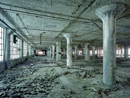
Auto Body Plant, Detroit

Auto Body Plant, Detroit

Its hard not to notice the circulation of apocalyptic images of the city: abandoned suburbs, boarded up rowhouses, (the ‘vacants’ as they were called on The Wire, where they were used to house the city’s dead), shuttered factories, and empty storefronts.

Florida Foreclosures

Florida Foreclosures

Over twenty years ago, Marshall Berman coined the term ‘urbicide’ to catalogue the wholesale destruction of his South Bronx neighbourhood, a place where ‘more than 300,000 people fled in the 1970s as their homes were …destroyed.’ In the 1970s he says, the South Bronx were the greatest ruins outside of Beruit:

‘these stricken people belong to one of the largest shadow communities in the world, victims of a great crime without a name. Let us give it a name  now he says, and calls it urbicide, the murder of a city.

Cinncinati

Cincinnati

Erich Hanxleden sent in a striking photo essay from Time maganize which documents Detroit’s ‘beautiful, horrible decline’, or we could say, the urbicide the city. Today, we bear collective witnessness to the methodical murder of one of the most powerful cities in the history of 2oth century America. What is the social significance in documenting Detroit’s landscapes of dereliction (along with others in Cleveland, Braddock, suburban Minneapolis, Florida, etc)? How do these landscapes reveal the world of globalized economies? Whose voices are absent as we document the urbicide of US cities and suburbs?

Cognitive Mapping: An image of the city from the perspective of Geography 101

Posted in Cultural Geography, Urban Geography on February 17, 2009 by geography101

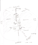
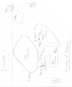
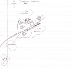
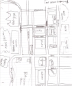
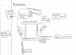
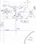
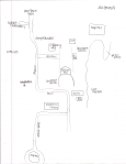
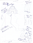
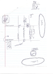
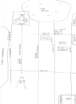
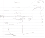
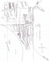
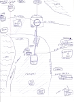
Well some clear themes emerged out of our cognitive mapping exercise today. I’ve chosen a random sample, so have a look at the maps (click to enlarge them). What dominant nodes, edges, districts, landmarks and paths can you discern? Where is the focal point for most of the maps? What forms the periphery.? What kind of story do these maps tell us about our spatial practices? Is it possible to tell how we get around (ie walking, busing, biking, driving?)? Where we shop? Where we relax? Where we spend most of our time? How are our social relations, identities, and everyday lives inscribed in our image of the city?

sc0001488asc00016bc9sc0001aa3asc000122b5sc00006614sc0000514bsc000209efsc000183b9sc000122b51sc0000b775sc00023448sc00019470sc00015978sc0001363fsc0001f655sc0001c5c3sc0000f75fsc0000c789sc0000de571

sc000025e4sc00021f60sc00024b11sc00007dc9sc0002b7f9sc0002a290sc00010e08

Focus: Hope, a grassroots project rebuilding Detroit

Posted in Economic Geography, Urban Geography on February 12, 2009 by geography101

This PBS story was sent to us by your class mate Natasha Dockter, who thought it tied well into out focus on Detroit and its changing economy. One of the most interesting side stories contained within this facinating video is how a  job training and production centre for young inner city people reinvented itself from serving the auto industry to serving the military. While this video does not dwell on this transformation, it raises important questions about the military and war as growing economic industries unto themselves. This is a question that often gets overlooked in discussions about spatial transformations of post-fordism. Vodpod videos no longer available.

more about “Online NewsHour: Social Entrepreneurs…“, posted with vodpod